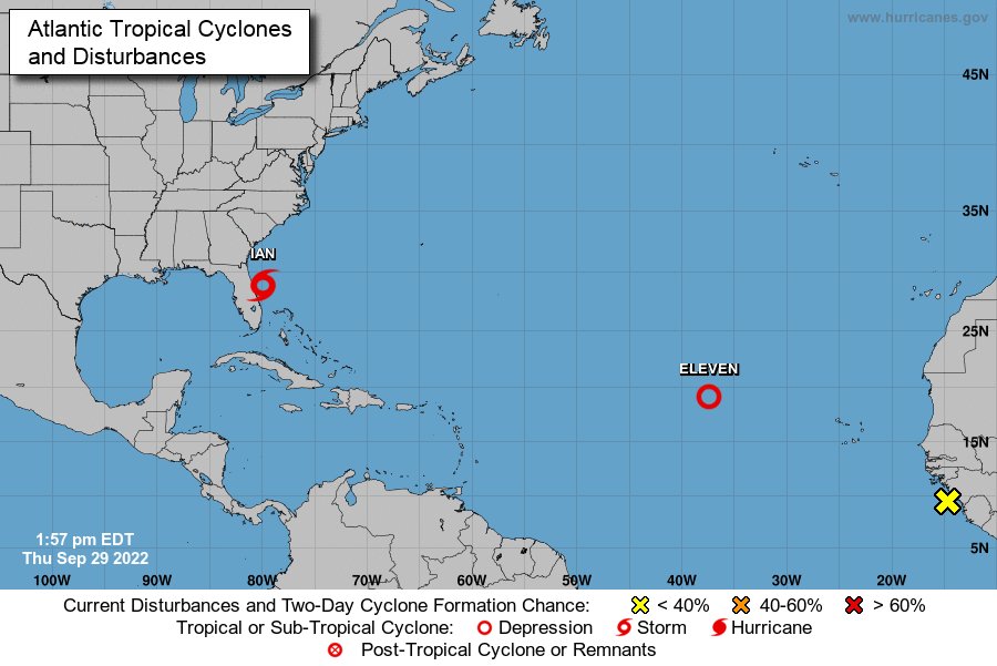
City officials continued to keep a keen eye on Tropical Storm Ian as the storm pounded Florida and was forecast to move toward the Carolinas.
In anticipation of heavy rain, Cumberland County Schools said Thursday that students will be in remote learning on Friday, Sept. 30. Click here for more on schools storm plan.
According to online news reports, the storm left more than 2 million Florida residents without power. Ian has downgraded to a tropical storm but is expected to strengthen over the next day.
Cumberland County offices closed Friday because of storm.
Weather forecast prompts city offices, recreation programs to close.
South Carolina is under a hurricane warning as Ian was forecast to approach its coast in the Charleston area before moving inland.
Scott Bullard, emergency management coordinator for Fayetteville, said city workers have checked and prepped about everything that can be to prepare for whatever comes this way.
“There’s not a lot more we can do. We’re used to this process,” Bullard said. “We still have the scars from (Hurricanes) Matthew and Florence. We’re just kind of waiting for more data on the track of this thing.
“We know it’s going back out over the water and coming back ashore in lower South Carolina,” Bullard said. “Just looking at the arrival of the wind and the rain.”
Based on National Weather Service reports, Bullard said, residents here can expect tropical-storm-force winds early Friday morning.
“That could be even before we wake up or even see an edge of it,” he said. “And they’re saying we could have some (wind) gusts certainly over 35 (mph), but I don't foresee anything as high as 50. There again, you may have one (gust) that didn't read the book.”
In terms of potential rainfall, Bullard said, “They just reiterated on the rain (there's) still that broad swath of 2 to 6 inches, just depending on where you’re going to be at. That’s over the whole course of this thing. It’s not a one-day thing; it’s more a three-day process. And I think as dry as we are, we can take the rain.”
Major flooding is not expected along the Cape Fear River, he said.
“They’re paying lip service to flash flooding, which we can have that on a good old August summer day,” Bullard said. “I thnk the key is just going to be to get where you need to be on Friday and get off the roads if it does get kind of rough and get on with life.”
Gene Booth, director of Cumberland County Emergency Services, said the county has been monitoring the storm since it developed.
"We always plan for the worst and hope for the best," he said.
The county, Booth said, laid out plans early should an emergency shelter and emergency operations center be necessary along with making contact "with all partners in emergency and disaster response."
That included making sure that all county equipment is ready if needed.
He said the county will be closely monitoring the progress of the storm throughout the day on Friday.
"This is no Matthew. This is no Florence," he said, referring to a couple of major hurricanes that wreaked havoc in the Fayetteville area in years past.
"It's always good to be prepared," he said. "There could be some power outages. They could be eight, 12 hours (to get to); just depends on how long it takes for utilities to get out there and when it's safe for them to get out there. There's a potential for some downed threes. It could cause some power outages."
Should residents be concerned about Ian?
"I would pay attention to localized flooding," Booth said. "Don't travel if you don't need to travel. If you come to an area where there's flash flooding — the typical hot spots if you come to those — don't ever drive through water. Turn around. Find another way. We're looking at heavy rain at times and gusty winds at time during the day."
Booth suggested that residents should sign up for Cumberland Alerts on the county website, which provides weather-related updates from the Cumberland County Emergency Services.
Jonathan Blaes, a meteorologist with the Raleigh office of the National Weather Service, said about 12:45 p.m. Thursday that the storm system had left Florida and been downgraded to a tropical storm. It was expected to intensify over the Atlantic Ocean and become a minimal-strength hurricane later Thursday. Based on Thursday’s projections, the storm will make landfall again in coastal South Carolina at midday Friday, Blaes said.
That, he noted, will be in the vicinity of Charleston.
“The center of the system will then track north to northwest out to the North Carolina mountains by Saturday,” he said.
Fayetteville “certainly will not be the heart of the storm,” Blaes said.
“There certainly will be some nasty weather there,” he added. “There will be some spotty showers that move into the area this afternoon and into the evening. Later tonight, a little bit steadier rain is expected to move into the area where the rain becomes steadier and heavier (Friday) morning.”
Friday afternoon and evening, “it’s likely to be pretty nasty with periods of heavy rain, gusty winds and a threat for some localized flooding in the flood-prone, low-lying areas,” Blaes said. “Also, with the winds there could be some localized power outages, as well.”
The worst conditions for this area will be on Friday afternoon and evening, he said.
There is a possibility of an isolated tornado late Friday afternoon, said Blaes, but the greater threat for tornadoes would be east of the area out toward the coast.
“So, the morning commute tomorrow won't be that great,” Blaes said. “The afternoon commute tomorrow will be nasty. We’re looking at wind gusts reaching 40- to maybe 45-mph range, maybe a little stronger. Doesn’t look like it will be total chaos, but there will be some hazards with that. We expect 3 to 6 inches of rain in that area. That could result in some flash flooding in some areas, low-lying creeks and that kind of stuff.”
Conditions should improve noticeably by Saturday morning, Blaes said. By Saturday afternoon, weather conditions should have settled with a little breeze and scattered showers.
Because of relatively low rainfall amounts, he said, the Cape Fear River is not expected to be a concern. Smaller creeks and streams might be a bigger issue, he said.
Carolyn Justice-Hinson, a spokeswoman for the Fayetteville Public Works Commission, did not immediately respond to a phone message Thursday.
The city's Bullard said his main concern is for people who might drive a little faster than they should under the weather conditions — especially those who are not familiar with the area.
“If you don’t know more than one way to get to where you’re going, then that kind of applies to you,” he said. “I think ultimately, we just want patience. Slow down. And we always repeat the ‘Turn around, don’t drown.’ For whatever reason, if you run across some water, don’t go through it.”
As for the potential for an isolated tornado, Bullard said, “Well the graphic that they just showed (about noon), all of that looks like east of I-95 and the river, and Fayetteville would be on the extreme western edge of that line that they drew. When you say anything is possible, I think there’s a slight, tiny chance, but I think that’s what it is on this go round.”
The city has a flood awareness page with information about stormwater at Flood Awareness Map (arcgis.com). City residents can post their address to see if their property has been prone to flooding in years past.
Michael Futch covers Fayetteville and education for CityView. He can be reached at mfutch@cityviewnc.com.